
Capture Reality. Build Smarter.
Marnell VizWorks provides aerial mapping, digital twin, and geospatial data services that help contractors, developers, engineers, architects, and visualization teams improve planning, coordination, documentation, measurement support, and project decision making.
Who We Support
General Contractors | Developers | Engineers & Architects | Visualization Teams
• Preconstruction Planning
• Design Coordination
• Site Documentation
• Progress Verification
• Quantity Tracking
• Stakeholder Reporting
• Construction-Focused Perspective
• Reliable & Repeatable Data Capture
• Fast Turnaround
• FAA Part 107 Licensed & Insured
• RTK Enabled Workflow Support
• Actionable Site Intelligence
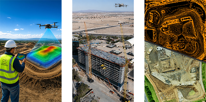
• Existing Condition Mapping
• Orthomosaic Site Mapping
• 3D Reality Capture Models
• Terrain & Surface Data Collection
• Progress Monitoring
• Earthwork & Stockpile Support
• Visualization Reference Capture
• Georeferenced Orthomosaics
• Point Clouds
• Surface Models
• Contours
• Volumetric Calculations
• CAD / GIS - Compatible Data
• Digital Twins
Services are provided for mapping, measurement support, documentation, and visualization purposes and are not represented as legal land surveying unless performed in coordination with a licensed survey professional.